|
|||

Look as Sharp as your hooks Click here for the latest in Walleyes Inc. outdoor wear Promotional Team Favorites Lodging food and more 
Free 90 day Risk free trial offer click here 
|
Road Map to More Walleyes by Rick Olson
Learning to read a lake map is an important element of successful walleye angling, and is a tool that top pros rely on heavily, especially when looking for hot spots on new bodies of water. A good map will give you an idea of just exactly how things are laid out, and where potential fish holding areas might exist. Understanding what to look for, and where to look for it, can save you precious time. It can also help you maximize your opportunities, and increase your chances for getting in on the catch of a lifetime. Proficient map readers can take a look at a map and quickly narrow down the potential hangouts in a matter of minutes, which allows them to spend more time fishing in an areas that have a high chance of producing. Spending more time in likely areas is a matter of efficiency, and is the key to getting the most out of a situation. Finding likely looking areas requires more than a simple once over look at a map, as there are other factors that must be first considered. Factors like seasonal movements and water clarity can have a major effect on walleye location, and must be taken in consideration, when trying to put it all together. Seasonal movements include a shallow, to deep, to shallow migration, that spans the open water season. That progression may be altered by other factors like dark or dirty water, which might completely eliminate the deep water option. Dark or dirty water can keep walleyes shallow all season long, and greatly reduce the number of deeper options, and potential holding areas. On the other hand, while dark water can reduce the deep water options, it may also increase the number of shallow water areas that could be holding fish. After youve determined seasonal and clarity conditions, you can then
take a look at a map and start to look for areas that might fit into the
program. If youre looking for early season hot spots, try to find
shallower bars, reefs, and maybe even some flats. If youre
already into the summer period, look for deeper structure, like underwater
points and humps. If youre heading into the fall, you may need to
find a combination of the two.
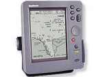
A contour line is simply a constant depth reading, that can reveal the presence, or lack thereof, of structure. Following a contour line will also reveal the shape and characteristics of the bottom, and give you a rather rough picture of whats down below. Contour lines that pull tight together indicate a fast change in depth, while wider lines suggest more of a slope, or slow drop. The absence of a contour line indicates a constant depth, or flat. Fast drops are usually associated with a hard bottom, while slower drops may or may not by associated with a softer bottom. A small turn or change in a contour line may be the only indication youre going to get of an underwater point or bar, and will have to be checked out with a good graph to be sure. Those smaller, less obvious areas, are the secret spots that youll probably want to keep to yourself, once found. When working from a map on a new lake, it would be a good idea to first get familiar with the major and more obvious structure, before looking for the secondary spots. By working the major areas first, you can get an idea of how and where fish are relating to it, and will give you an idea of what to look for in a secondary spot. Finding structure by way of a contour map takes a little effort, and can be especially trying when you get offshore. Shoreline structure is a whole lot easier to locate, as you can key off of major points, public accesses, roads etc. Once you move away from shore, youll have to utilize a combination of those same landmarks, and combine it with your depthfinder.
Rick Olson Fish Clix Banner Exchange Please visit these site sponsors |
||
|---|---|---|---|